District de Satara
- District de Satara
-

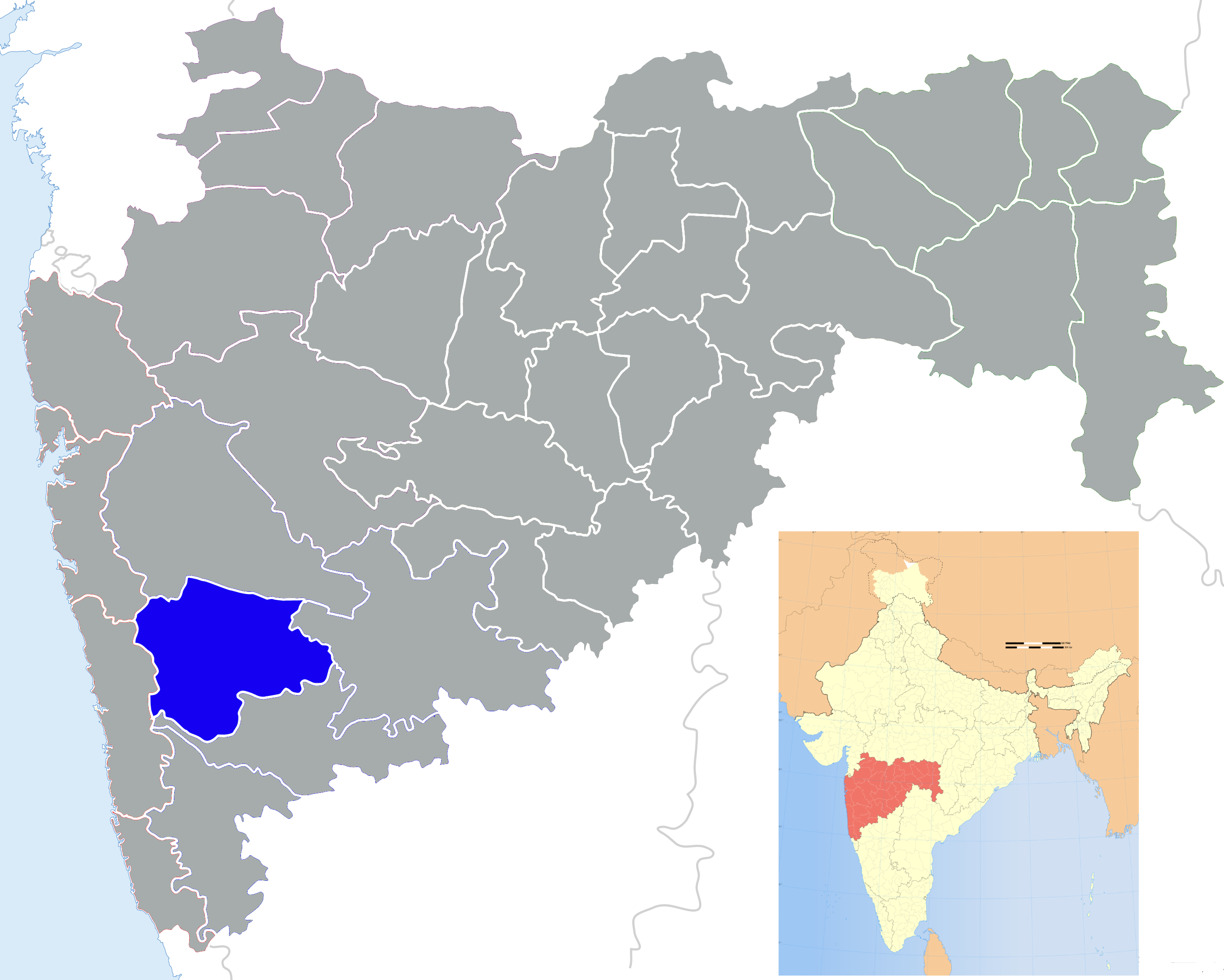
Le district de Satara dans le Maharashtra
Le district de Satara est un des 35 districts du Maharashtra.
Son chef-lieu est la ville de Satara. Au recensement de 2001, sa population était de 2 808 994 habitants pour une superficie de 10 480 km².
Liste des Tehsil
Il est divisé en onze Tehsil :
- Mahabaleshwar
- Wai
- Khandala
- Phaltan
- Man
- Khatav
- Koregaon
- Satara
- Jaoli
- Patan
- Karad
Wikimedia Foundation.
2010.
Contenu soumis à la licence CC-BY-SA. Source : Article District de Satara de Wikipédia en français (auteurs)
Regardez d'autres dictionnaires:
Satara (ville) — Satara (en marathi : सातारा) est une ville du Maharashtra, en Inde, et le chef lieu du district de Satara. Elle compte 108 043 habitants (2001). Située près de la confluence du Krishnâ et du Venna, à 112 km au sud de Pune, son nom dérive des … Wikipédia en Français
Satara (city) — For the moth genus, see Satara (moth). सातारा Satara The city of Maratha warriors, history, kings, pensioners and nature … Wikipedia
Satara — For the moth genus, see Satara (moth).Infobox Indian Jurisdiction native name=Satara type= City latd = 17.69139|longd=74.00092 locator position=right state name=Maharashtra district=Satara leader title=Mayor leader name=Mr. Nishanth Patil… … Wikipedia
Satara district — This article is about the district. For its eponymous headquarters, see Satara. Satara district सातारा जिल्हा Location of Satara district in Maharashtra … Wikipedia
Ratnagiri district — Ratnagiri(रत्नागिरी)(رتناگری) is a district in Maharashtraمھاراشٹر, India. Nearly 400 km from Mumbai. It has the distinction of being the native place of three Bharat Ratna awardees, namely Maharishi Karve, Dr. Pandurang Vaman Kane and Dr.B.R.… … Wikipedia
Karanje Turf Satara — Infobox Indian Jurisdiction native name = Karanje Turf Satara | type = city | latd = | longd = state name = Maharashtra district = Satara leader title = leader name = altitude = population as of = 2001 population total = 21,503| population… … Wikipedia
Nandurbar district — This article is about the district. For its eponymous headquarters, see Nandurbar. Nandurbar district … Wikipedia
Bijapur district — Infobox Indian Jurisdiction native name=Bijapur District type=district latd = 16.82 longd = 75.72 taluk names = Bijapur, Bagewadi, Sindgi, Indi, Muddebihal, Basavan Bagewadi hq = Bijapur state name=Karnataka leader title = leader name = area… … Wikipedia
Raigad district — This article is about a district in Maharashtra. For a district in Chhatisgarh, see Raigarh district. Raigad district रायगड जिल्हा Location of Raigad distr … Wikipedia
Nagpur district — This article is about the district. For its eponymous headquarters, see Nagpur. Nagpur district नागपूर जिल्हा Location of Nagpur district in Maharashtra … Wikipedia