Anosibe Ifanja

Anosibe Ifanja

18° 31′ S 46° 27′ E / -18.52, 46.45

Anosibe Ifanja
Administration
Pays Drapeau de Madagascar Madagascar
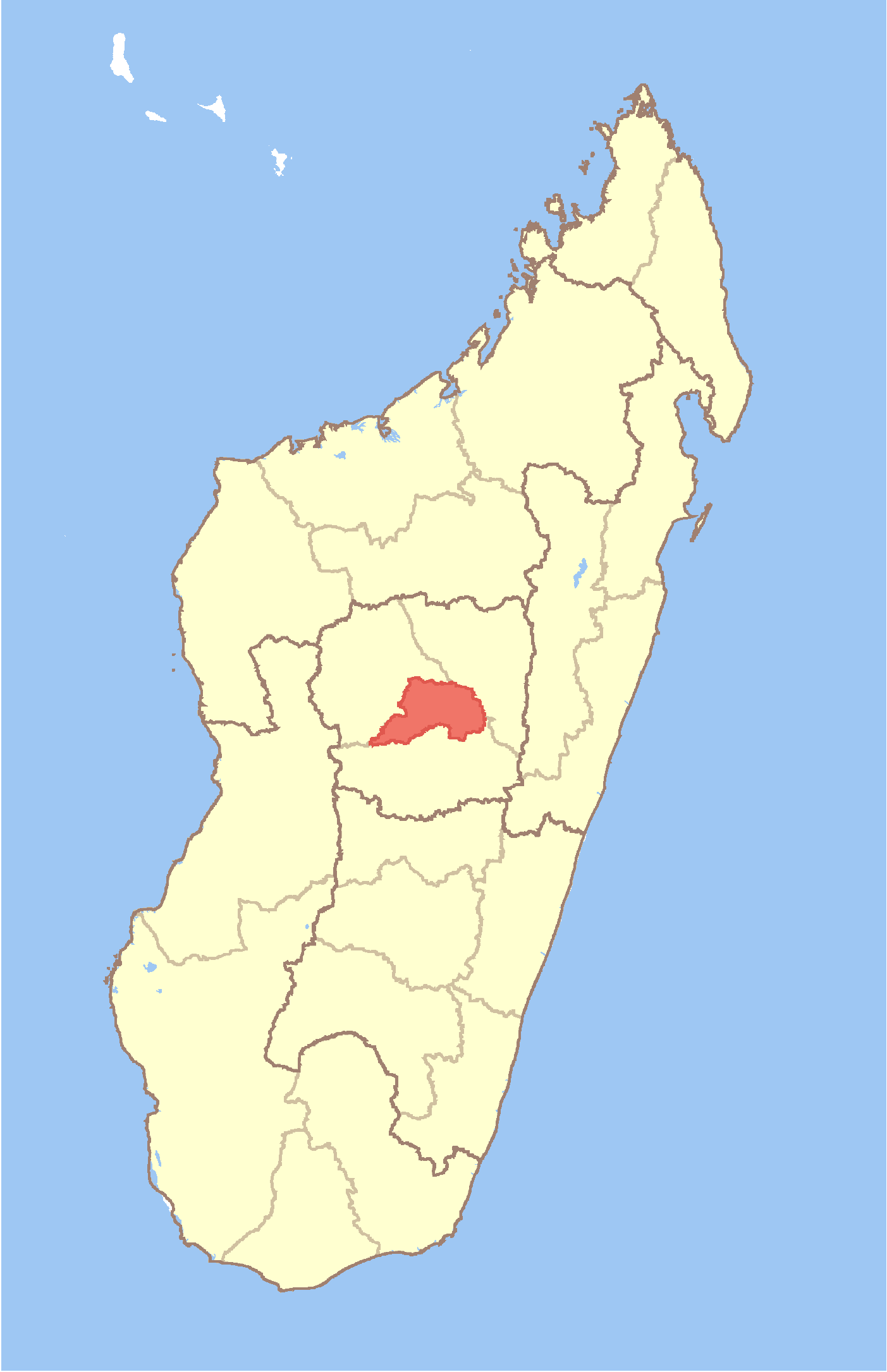
Région Itasy
Province Antananarivo
District Miarinarivo
Géographie
Coordonnées 18° 31′ Sud
       46° 27′ Est
/ -18.52, 46.45
Altitude 1 082 m
Démographie
Population 17 000 hab. (est. 2001)
Localisation
Madagascar location map.svg
City locator 13.svg

Anosibe Ifanja est une commune urbaine située dans la Province de Tananarive, au centre du Madagascar.

Géographie

Histoire

Économie


Wikimedia Foundation. 2010.

Contenu soumis à la licence CC-BY-SA. Source : Article Anosibe Ifanja de Wikipédia en français (auteurs)

Игры ⚽ Нужно сделать НИР?

Regardez d'autres dictionnaires:

  • Anosibe Ifanja — Infobox Settlement official name = Anosibe Ifanja other name = native name = nickname = settlement type = motto = imagesize = image caption = flag size = image seal size = image shield = shield size = image blank emblem = blank emblem type =… …   Wikipedia

  • Sarobaratra Ifanja — 18° 29′ S 46° 26′ E / 18.48, 46.44 …   Wikipédia en Français

  • Miarinarivo — For other places with the same name, see Miarinarivo (disambiguation). Miarinarivo Map of Antananarivo Province showing the location of Miarinarivo (red). Country Madagascar Region Itasy …   Wikipedia

  • Mahatsinjo Est — Mahatsinjo Est …   Wikipedia

  • Manalalondo — Manalalondo …   Wikipedia

  • Marofangady — Marofangady …   Wikipedia

  • Miantsoarivo — Miantsoarivo …   Wikipedia

  • Morafeno, Arivonimamo — Morafeno …   Wikipedia

  • Morarano, Arivonimamo — Morarano …   Wikipedia

  • Manazary — Manazary …   Wikipedia

Share the article and excerpts

Direct link
Do a right-click on the link above
and select “Copy Link”