Tupanci
- Tupanci
-
Tupanci (en serbe cyrillique : Тупанци) est un village de Serbie situé sur le territoire de la Ville de Valjevo, district de Kolubara. En 2002, il comptait 158 habitants[1], tous serbes[2].
Démographie
Évolution démographique
| 1948 |
1953 |
1961 |
1971 |
1981 |
1991 |
2002 |
| 344 |
342 |
310 |
278 |
222 |
187 |
158[1] |
Notes et références
- ↑ a et b (sr) Livre 9, Population, analyse comparative de la population en 1948, 1953, 1961, 1971, 1981, 1991 et 2002, données par localités, Institut de statistique de la République de Serbie, Belgrade, mai 2004 (ISBN 86-84433-14-9)
- ↑ (sr) Livre 1, Population, origine nationale ou ethnique, données par localités, Institut de statistique de la République de Serbie, Belgrade, février 2003 (ISBN 86-84433-00-9)
Voir aussi
Sur les autres projets Wikimedia :
Articles connexes
Liens externes
Wikimedia Foundation.
2010.
Contenu soumis à la licence CC-BY-SA. Source : Article Tupanci de Wikipédia en français (auteurs)
Regardez d'autres dictionnaires:
Tupanci do Sul — is a municipality in the state Rio Grande do Sul, Brazil.ee also*List of municipalities in Rio Grande do Sul … Wikipedia
Tupanci do Sul — es un municipio brasileño del estado de Rio Grande do Sul. Se encuentra ubicado a una latitud de 27º55 31 Sur y una longitud de 51º32 11 Oeste, estando a una altura de 824 metros sobre el nivel del mar. Su población estimada para el año 2004 era… … Wikipedia Español
Tupanci Do Sul — Admin ASC 2 Code Orig. name Tupanci do Sul Country and Admin Code BR.23.4322186 BR … World countries Adminstrative division ASC I-II
List of municipalities in Rio Grande do Sul — Municipalities of Rio Grande do Sul, Brazil This is a list of the municipalities in the state of Rio Grande do Sul (RS), Brazil. Mesoregion Microregion Municipality Centro Ocidental Rio Grandense Restinga Seca … Wikipedia
Valjevo — Ваљевo Héraldique … Wikipédia en Français
Муниципалитеты штата Риу-Гранди-ду-Сул — … Википедия
Тупанси-ду-Сул — Муниципалитет Тупанси ду Сул Tupanci do Sul Страна БразилияБразилия … Википедия
Montenegro, Rio Grande do Sul — This article is about a city in Brazil. For other places named Montenegro, see Montenegro (disambiguation). Montenegro is a city and municipality of the state of Rio Grande do Sul, Brazil; 59.000 inhabitants. The town was established in 1847 to… … Wikipedia
Nova Petrópolis — Coordinates: 23°31′43″S 46°20′42″W / 23.52861°S 46.345°W / 23.52861; 46.345 … Wikipedia
Novo Hamburgo — City of Novo Hamburgo From upper left: Ernesto Frederico Scheffel Foundation, Cathedral Basilica of St. Louis Gonzaga, Monument to the Shoemaker, Friedrich Museum, Schmitt Presser Museum, and Panoramic view of Novo Hamburgo … Wikipedia
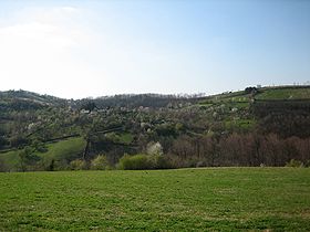 Vue générale de Tupanci
 Serbie
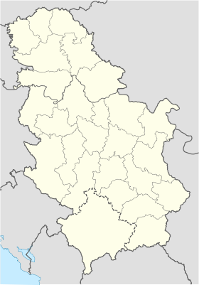
 Tupanci
