Lower Chindwin
- Lower Chindwin
-
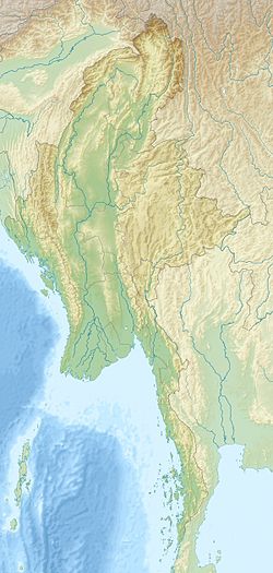
Le Lower Chindwin (littéralement : basse Chindwin) est un massif volcanique du nord-ouest de la Birmanie, bordant la rivière Chindwin dans la région de Sagaing.
Il se caractérise par la présence de plusieurs cratères d'explosion remplis d'eau ou maars, et de cônes de cendres. Les coulées de laves sont basaltiques et sont datés généralement du Pléistocène et du Pliocène, certaines coulée semblent être plus récentes.
Source
Wikimedia Foundation.
2010.
Contenu soumis à la licence CC-BY-SA. Source : Article Lower Chindwin de Wikipédia en français (auteurs)
Regardez d'autres dictionnaires:
Chindwin (Chindwinn) River — One of Burma s largest river systems, with a length of 800 kilometers. It rises in the Kumon Mountains of Kachin State and flows through the Naga Hills (Sagaing Division) to join the Irrawaddy (Ayeyarwady) River north of Pagan (Bagan). The… … Historical Dictionary of Burma (Myanmar)
Myanmar — /muy ahn mah/, n. Union of, official name of Burma. * * * I or Burma officially Union of Myanmar Country, Southeast Asia, on the Bay of Bengal and the Andaman Sea. Area: 261,228 sq mi (676,577 sq km). Population (2002 est.): 42,238,000. Capital:… … Universalium
Irrawaddy River — Coordinates: 15°51′19″N 95°14′27″E / 15.85528°N 95.24083°E / 15.85528; 95.24083 … Wikipedia
Burmese gray wild dog — Infobox Paranormalcreatures Creature Name = Gray Dhole Image Caption = Grouping = Cryptid Sub Grouping = Canine Country = Burma Region = Habitat = forest First Reported = 1913 Last Sighted = 1936 Status = UnconfirmedGray Dhole, also known as… … Wikipedia
Cattle in religion — In Hinduism, the cow is a symbol of wealth, strength, abundance, selfless giving and a full Earthly life Cattle are considered sacred in various world religions, most notably Hinduism, Jainism, Buddhism[citation needed] … Wikipedia
Liste Des Volcans D'Asie — Sommaire 1 Afghanistan 2 Arabie saoudite 3 Arménie 4 Birmanie 5 … Wikipédia en Français
Liste des volcans d'Asie — Sommaire 1 Afghanistan 2 Arabie saoudite 3 Arménie 4 Birmanie 5 Chine … Wikipédia en Français
Liste des volcans d'asie — Sommaire 1 Afghanistan 2 Arabie saoudite 3 Arménie 4 Birmanie 5 … Wikipédia en Français
Liste von Vulkanen — Karte mit allen Koordinaten: OSM, Google oder … Deutsch Wikipedia
World War II — the war between the Axis and the Allies, beginning on September 1, 1939, with the German invasion of Poland and ending with the surrender of Germany on May 8, 1945, and of Japan on August 14, 1945. Abbr.: WWII * * * or Second World War (1939–45)… … Universalium

 Birmanie